
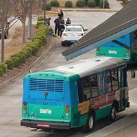
In light of the recent altercation at the Huntsville City Transportation Bus Station located on Cleveland Ave., I
thought this would be a good time to take a look back at some notes I made in 1999 prior to the
construction of the Transportation Bus Station. The Map I and Map II notes come from an old page on TOCC TV and have not been edited since then.
After reviewing all the information available, it turns out that the current Huntsville City Transportation Bus Station is built immediately on top of the original Huntsville Train Shops that were built around 1860. In fact, it seems highly likely that the digital time and temperature display located in the center of the bus terminal awning, is just about exactly in the center of the original turntable location.
2015.12.21 Huntsville Depot Complex 1861
2015.12.21 Huntsville Depot Complex Circa Civil War (Pagan Ritualism Circa 2015)
Roll Baby Roll!
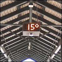
The Huntsville City Bus Station Reveals Cold Temperature
Huntsville Bus Station Spotlight – Ass Whoopin
There is, however, substantial evidence that this event was deliberately orchestrated to place a spotlight on the Lee High School Bus conspiracy massacre that occurred near this location in 2006, and is part of a conspiracy inspired and orchestrated by the recently announced seditious caliphate lead by Connecticut Governor Daniel P. Malloy, and US President Barack Obama. In short, this event is a conspiracy and a premeditated act of domestic terrorism by definition.
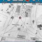
Depot Complex Maps I These maps of the Huntsville Depot Complex are circa 1888 – 1898. The drawing was stitched together using two maps, one each from 1888 and 1898. The facilities, however, were completed by 1864, and these maps represent a very accurate depiction of that time period.
Noting the scale and relatively small area involved, it is easy enough to determine the proximity of the still standing Depot and Freight building to the original Turn Table and shops.
These maps were originally taken from insurance maps that are very accurate. However, the maps that were actually copied for this presentation may have been second or third generation copies themselves. The scale on the two maps is exactly the same, however, some scaling was necessary in order to bring all points to a perfect fit. As such, horizontal and vertical scale may be off somewhat. Given the relatively small area involved, it shouldn’t be more than a few feet (+/-~10′) across the entire map.
When using the old fashioned rudimentary measure of pacing it off, Cleveland Street seems to fall about 80 feet further North than these maps would indicate. Again, total measurement error shouldn’t be as far off as the Cleveland Street discrepancy would seem to indicate.
A later map that is less detailed, and whose accuracy cannot be considered as accurate, seems to show Cleveland slightly further South – by about 50 feet or so. This would be consistent with the pacing measure, but other clues seem to indicate that the western mouth of Cleveland is still in the same spot.
One clue is the area found during the excavation that clearly was a “pit” of ashes that measures 4-5 feet deep and approximately 75 feet across. That would be consistent with the notion that when the shops were demolished, they were burned down with the ashes being piled into the Turn Table pit, to fill it prior to being covered over.
*These maps originate from — The Sandbord Map & Publishing Co., Limited — and were first published in 1888 and 1898. Subsequently, they are on record with the Library of Congress photoduplication service. Hard copies are on record in the Heritage Room of the Huntsville/Madison County Public Library, and can be reviewed by the public. Efforts to find these maps online with the LOC were not successful, probably due to the large volumes of material currently in the process of being documented for the Internet by the LOC.
Depot Complex Maps II This is the same composite map used above, and so has the same minor problems with scale.
The yellow tinted corner section represents the area of the current construction project, and is based on the (somewhat suspicious) location of Cleveland Street’s large mouth on the West side.
The green lines represent the continuation of Cleveland Street to the East, and also assumes the mouth of Cleveland to the west to be in the exact same location. The additional green lines represent the Interstate, and it’s ramps (6 overpasses in all), that pass over the site parallel to Cleveland, as well the Washington Street access ramps (2 overpasses) that run perpendicular to both. All green lines, and the yellow construction area, are based on the proximate location of the Western mouth of Cleveland Street.
If the western mouth of Cleveland Street was moved to the South, by about 50 to 80 feet, then all the proximate roadway locations represented by the green lines, as well as the yellow tinted construction area, would actaully be further north by that amount. The proximate east-west location of the Washington Street ramps would be essentially unaffected since they run north-south.
Either way, in the final analysis, the original site of Turn Table and Shops is being encroached upon by the current construction project.
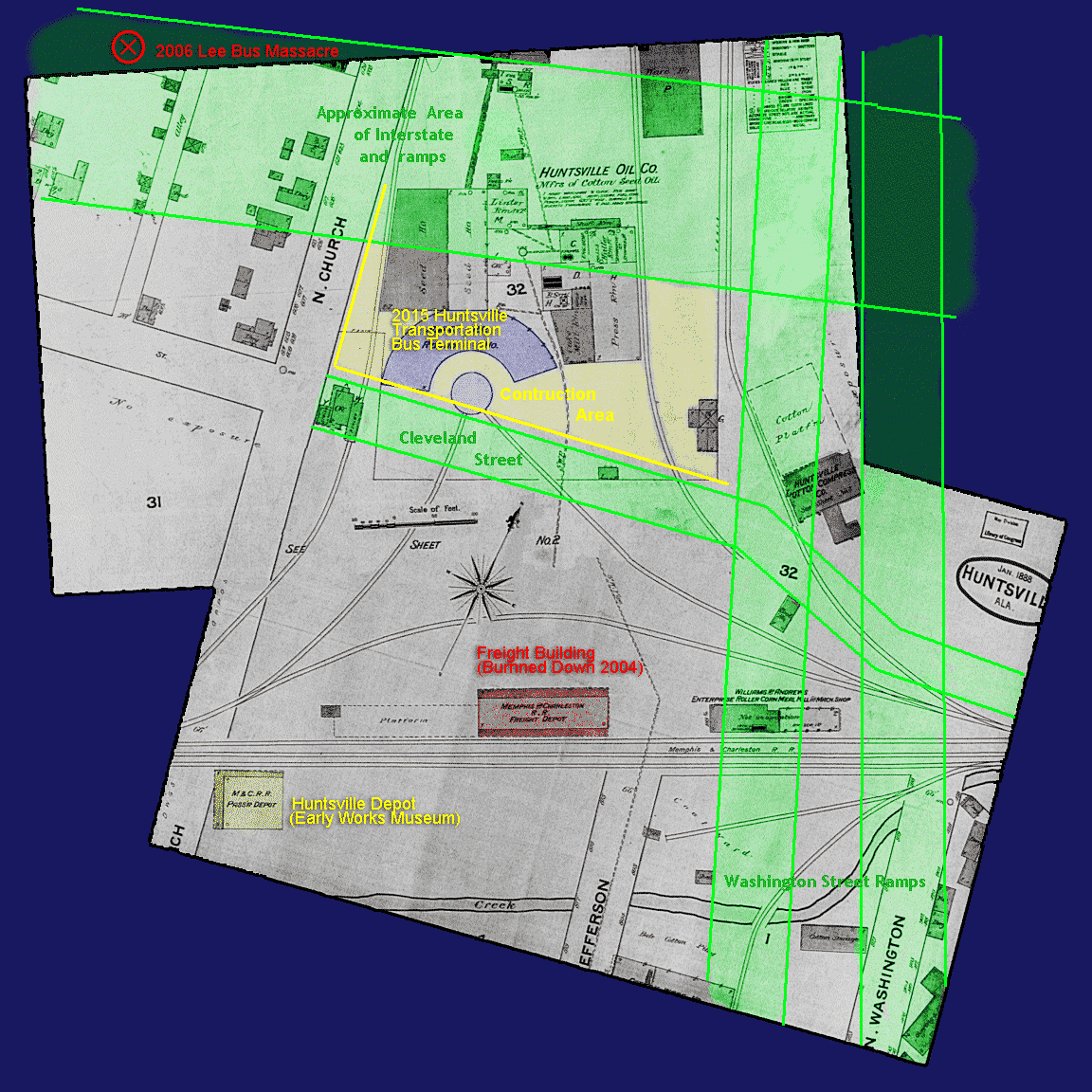
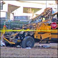
The location of the Lee High School Bus Massacre that occurred on
November 20, 2006 has also been added to Map II, indicated by the red X in the top left corner. The exact location where the bus
hit the ground, killing one on the scene and three more in the days to come, might vary by 25 ft or so. In fact, it is possible that the point of impact was just slightly further south and east, and therefore would actually be on the map. Adding another layer of tragedy to the event, one of the Lee bus survivors was also killed later in an accident near the Governor’s Drive overlook on Monte Sano mountain.
Lee High School Bus Crash Conspiracy
REVISION (2014.06.07): It should be noted that State of Alabama DOT officials have never explained publicly why they removed EVERY gate from ALL fenced areas under the elevated portions of I565 in Huntsville, from Oakwood Ave. to Jordan Lane, three months before the Lee Bus Massacre. The removal of the gate on Church Street did facilitate fast access to the bus crash and the victims, however, prescience seems to be indicated.
Lee High School Bus Massacre
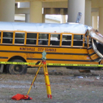
The four young ladies who have died as a result of what ultimately was an act of domestic terrorism are: Christine Collier, Nichole Ford, Tanisha Hill, and Krystal McCrary.